Planning your next road trip? We’ve listed the best ones around the UK and Ireland

We’ve all been there—gazing out the window, daydreaming of winding roads, salty air, and Spotify’s finest driving playlist blasting in the background.

But who says the ultimate road trip needs a passport stamp?

Flying down Route 66, cruising through the Alps, or admiring the Italian countryside, adorned with vineyards and sun-bleached white houses.

All these sound like a dream.

But did you know there are some pretty awesome road trips a bit closer to home? In the UK and Ireland, to be precise.

Whether you’re looking for a short-but-spectacular weekend getaway, or you want to explore the depths and breadths of the country over a week or two, you’ll be amazed at what’s on offer.

highland-cow

Highland Cow

Before you set off

Before you roar off into the horizon with snacks in the glovebox and dreams of detours, make sure your trusty steed’s up to scratch.

Depending on your route, you could be covering hundreds – or even thousands – of miles.

Pushing your car lease to its limits on mountainous, coastal or country roads.

It’s important to maintain your lease car before, during and after your journey, to make sure it’s always on top form and ready to go.

It might seem like a no-brainer, but a quick once-over of your car before you hit the road could save you a breakdown and a very awkward call to roadside assistance.

Check your oil and fluid levels, your wipers, and, of course, your tyres.

You want them all to be inflated correctly and have the right tread depth to keep you, your passengers and your vehicle safe while you’re away from home.

And – as with any road trip, whether you’re zooming down Route 66 or dodging sheep on the North Coast 500 – there will be times when you’re on a rural stretch of road with little or no facilities.

So, make sure you refuel when you can, and that you’ve thoroughly prepared by stocking your car with all the necessary driving essentials, including emergency blankets, a torch, a first-aid kit, basic tools, and a brolly.

Don’t forget to refuel with snacks.

Because no one’s their best self when their stomach’s doing donuts.

scotland-north-coast-500

North Coast 500

North Coast 500 – Scotland

Length: 500 miles

Route: Circular route from Inverness across to Applecross, up to Durness, across to John o’ Groats, and back down to Inverness

Starting at Inverness, the North Coast 500 (NC500) is a jaw-dropping journey - that gives the Odyssey a run for its money - across northern Scotland.

Dubbed ‘Scotland’s Route 66’, it’s the perfect UK road trip for any intrepid explorers. Or those who really, really like rugged coastal views and mountainous vistas.

The 500-mile route winds through a mix of remote country lanes and open roads. One minute you’re climbing through misty mountain passes, the next you’re hugging the coast with sea spray on your windscreen.

From Inverness you’ll head towards Applecross on the west coast.

Don’t forget to fuel up at Lochcarron – the last petrol station – before driving along Bealach na Ba (Gaelic for ‘pass of the cattle’), one of the most spectacular roads in the UK. The winding lane clings to the mountainside, down towards the Applecross peninsula.

It’s not a route for the faint-hearted, but for those brave enough to give it a good old-fashioned go, you’ll be richly rewarded with panoramic views over the sea and beyond.

When you reach the end, you’ll find the Applecross Inn, the perfect place to stop for a traditional Scottish meal overlooking the sea.

As you roam along the coast, the route stretches around the peninsula and continues north towards the village of Ullapool.

Despite being a small village, Ullapool is a popular destination, as it’s the largest settlement for miles. Continue on past Loch Assynt and the peak of Ben More, over the imposing Kylesku Bridge and on towards the north coast.

Durness is the first key stop on your north coast stretch.

Once you’re warmed up and refuelled, carry on driving along the north coast towards Thurso, a haven for surfers and one of the largest towns in the area.

From here, the NC500 bends around the top of the north coast, passing the most northern point in Britain – Dunnet Head near John O’ Groats – before dropping down to begin the northeast stretch.

This stretch of road is filled with historic sites, including Dunrobin Castle, so if you’re looking to combine your road trip with some history, this is a great area to visit.

Mosey on down the coast, and you’ll eventually meet Inverness again, bringing your epic escape to an end.

Don’t miss: Driving to the Applecross Peninsula, stopping to refuel in Ullapool, driving over Kylesku Bridge, a delicious pie at Lochinver Larder, exploring Smoo Cave, wandering to Dunnet Head at John O’ Groats, picking up some souvenirs at Black Isle Brewery, the sea stacks at Duncansby Head.

atlantic-highway

The Atlantic Highway

The Atlantic Highway – Devon & Cornwall

Length: 134 miles

Route: Bridgwater-Minehead-Barnstaple-Bude-Fraddon

As Devonians ourselves, this scenic road trip is one of our favourites.

If you like your road trips with a side of sea breeze and pasties, the Atlantic Highway delivers all that and more over 134 glorious miles of the South West.

Passing fishing villages, beautiful coastlines and some of the rural South West’s finest scenery, this seriously swoon-worthy driving route is often overshadowed.

Though the Highway technically begins in Barnstaple, the A39 stretches along the north coast of Devon into Somerset. Start at Bridgwater, take in the tree-lined Exmoor cliffs at Lynmouth and Porlock, before joining up with the official Atlantic Highway in North Devon.

From here, the A39 winds south towards the ancient town of Bideford, where you have the opportunity to take a small diversion to the adjacent villages of Appledore and Instow, or the wide-open beach of Westward Ho!.

Just a short stretch further, it’s worth stopping to wander the cobbled streets of Clovelly, a village that has remained unchanged for hundreds of years.

For those keen to delve deeper into Devon’s heritage on their road trip, Clovelly is a prime stop.

The beauty of the Atlantic Highway is its multitude of potential stops.

There’s something to see almost every few miles, so you can take your time meandering through Devon and Cornwall to transform this 134-mile journey into a weeklong trip.

Further south, on the Cornish border, the seaside town of Bude has two sandy beaches, stretching down towards Widemouth Bay.

From Widemouth, the Atlantic Highway veers further inland, but there’s an opportunity to follow the coastal road through some of North Cornwall’s prettiest towns and villages including Crackington Haven, Boscastle, Tintagel, Port Isaac and Polzeath.

You can then meet the A39 down towards Fraddon, where the Atlantic Highway ends.

Don’t miss: Walking through Clovelly, admiring the cliffs at Hartland Quay, walking through the gardens at Hartland Abbey, a cream tea at Docton Mill, a pub lunch at The Bush Inn Morwenstow, a stroll along the sand at Widemouth Bay, stepping back in time at Tintagel Castle.

wild-atlantic-way

Wild Atlantic Way

Wild Atlantic Way – Ireland

Length: 1,600 miles

Route: Along the Irish west coast from the Inishowen Peninsula down to Kinsale, County Cork

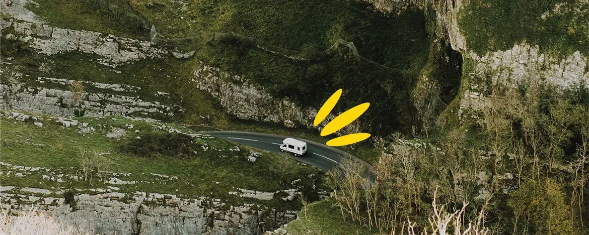
As the world’s longest defined coastal touring route, it’s difficult to imagine a more epic road trip than the Wild Atlantic Way.

Spanning 1,600 miles along Ireland’s west coast, this route offers drivers the opportunity of a lifetime.

From the secluded landscapes of County Mayo to the popular yet pretty County Kerry, the Wild Atlantic Way allows visitors to sample the best of Ireland’s scenery on one connected route.

Working from north to south, you’ll start in the Inishowen Peninsula.

As Ireland’s largest peninsula, it’s flanked by glorious beaches and craggy clifftops. The Gap of Mamore road on this stretch ascends to 800ft, giving you a spectacular view over the coast.

From here, the next section cuts through the remote Donegal countryside, twisting down the coast towards Sligo.

Mullaghmore Head is considered one of the finest examples of the landscape on the Wild Atlantic Way.

If you fancy a little detour, you can hop on a ferry over to the island of Inishmurray.

County Mayo, although not as well-known as the likes of County Kerry or Donegal, is one of the most remote stretches of the Wild Atlantic Way.

Impressive sea stacks, sweeping beaches and country lanes make this one of the most enchanting counties in Ireland.

Branch out to the Mullet Peninsula to find some of the best beaches. From Mayo, the road stretches down to Achill Island, Ireland’s largest island, historically famous for its population of basking sharks.

Today, its frontier feel draws visitors who wish to rest on the sand or admire the highest sea cliffs in the country.

The Wild Atlantic Way continues south, passing Croagh Patrick, Ireland’s sacred mountain, the valleys of Doo Lough and Delphi and Killary harbour.

Before long, you’ll find yourself approaching Connemara National Park and Ireland’s Sky Road, with panoramic views over the Atlantic.

Narrower roads wander down the coast before reaching Galway, a vibrant harbour city, which I’m sure you’ll have heard of from Ed Sheeran. If you haven’t heard of it, have you been living under a rock?

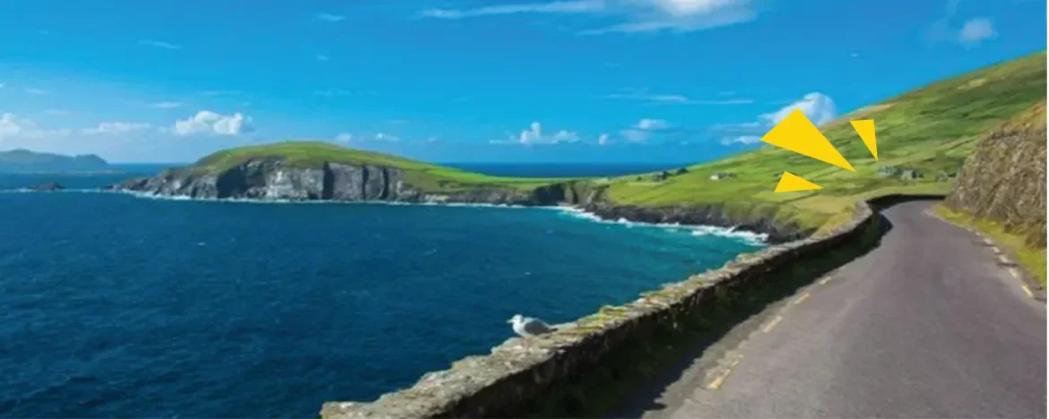
Continue past the famous Cliffs of Moher, past Kilkee and onto Tralee, before you reach the Dingle Peninsula.

But you can escape the crowds on Slea Head Drive, or take a boat over to the secluded Blasket Islands.

After taking your lease car for a spin around the Peninsula, continue to the iconic Ring of Kerry.

From here, you can reach the Skellig Islands, which featured in the final scene of Star Wars: The Force Awakens.

The route carries on further south, away from the busier areas of Dingle and Kerry, to bring you back to the remote beauty of the Ring of Beara, before stretching around the south-west of Ireland for the awesome conclusion to your trip.

Don’t miss: Walking on the sand at Mullaghmore, taking in the views at Keem Bay, looking up at the towering Croagh Patrick, diving into the Irish culture in Galway, looking out over the Cliffs of Moher, taking your car for a spin along Slea Head Drive and the Ring of Kerry.

glasgow-to-fort-william

A82 Glasgow to Fort William

A82 Glasgow to Fort William – Scotland

Length: 108 miles
Route: Glasgow - Bridge of Orchy - Glencoe - Fort William

Famous for being in scenes of the 2012 Bond film, Skyfall, in which Daniel Craig drove an Aston Martin DB5 through the mountains, this iconic road via Glencoe is well worth a visit.

As you make your way north from Glasgow, the scenery quickly transforms.

The industrial buildings and houses begin to disappear, and the lush forests surrounding Loch Lomond come into view.

The A82 closely follows the banks of the loch for 24 miles, meaning you don’t miss a moment of this iconic Scottish landmark.

When you’ve reached the end of the loch, the road begins to cut across the Trossachs, heading north to Glencoe.

The landscape changes again as you head towards the Bridge of Orchy, as the dramatic peaks of Glencoe slowly come into view.

Stop at the Green Welly Stop—not just for the name, but also because your legs will thank you.

With plenty of parking, a renowned whiskey shop (well, when in Scotland, it would be rude not to), gifts, clothes and delicious food, this is an excellent place to refuel for your road trip.

For a true taste of Scotland, try their Cullen Skink – a traditional Scottish soup made from the finest smoked haddock.

After driving for 90 miles, there’s no finer place to stop for a picnic than Glencoe.

The rest of the route is very picturesque, crossing over Loch Linnhe and hugging the banks up to the Fort, where you’ll find the imposing mountain of Ben Nevis.

Don’t miss: The views across Loch Lomond, the photo opportunity as you drive into Glencoe, lunch at the Kings House Hotel, the Three Sisters of Glencoe and a dram at the Clachaig Inn.

cheddar-gorge

Cheddar Gorge

Short but spectacular drives

Route: Cheddar Gorge – Somerset

Length: 14 miles

At almost 400ft deep and three miles long, Cheddar Gorge is the largest gorge in England.

Luckily, you can drive through the heart of this spectacular natural landscape.

Although it’s only a 14-mile route, it’s guaranteed to be one of the most incredible drives you’ll ever enjoy without escaping abroad.

Cheddar Gorge is over one million years old, making the area a fascinating place to visit.

Check out Cheddar Caves, wander through the village, and pick up some cheese from the Cheddar Gorge Cheese Company, before continuing your drive through Somerset.

Route: Abergwesyn Pass – Powys, Wales

Length: 20 miles

This steep, narrow road crosses the Cambrian Mountains in Wales.

At only 20 miles, it’s a short run.

But with the route offering panoramic views over the remote, hilly landscape, it’s well worth the visit.

With its hairpin bends and steep descents, it’s definitely a drive that’ll keep you on your toes.

The route climbs up Abergwesyn Pass, through the Devil’s Staircase, and onto beautiful conifer forests and desolate valleys. For those wishing to sample some of Wales’ wildest landscape, this is the perfect road.

Route: Snake Pass – Peak District

Length: 14 miles

Often hailed as one of the best driving roads, Snake Pass allows drivers the opportunity to cut through the heart of the dramatic Peak District landscape.

At the start of the descent into Glossop, it’s said you can see over the hills to Manchester on a clear day.

Drive over moody moorland as you twist your way through the countryside, pretend you’re in a music video as you gaze out over the bleak hills, and put your driving skills to the test with tricky bends and blind summits.

Route: Black Mountain Pass – Brecon Beacons, Wales

Length: 23 miles

Connecting the quaint market town of Llandovery with Gwaun-Cae-Gurwen in south Wales, Black Mountain Pass is not only spectacular, but also extremely practical.

If you’re looking for an easy way to cross the Brecon Beacons National Park without missing the views, this 23-mile stretch is perfect.

Keep your eyes peeled for stray sheep, and be mindful of the hairpin bends while you’re admiring the views though.

Route: A686 Penrith to Haydon Bridge – Cumbria & Northumberland

Length: 37 miles

Named one of the AA’s greatest drives in Britain, the A686 from Haydon Bridge in Northumberland to Penrith in Cumbria just had to make the cut.

You could even say we’ve left the best till last.

You’ll have to take the driving plunge to find out for yourself.

The long, sweeping sections of road offer incredible open views while the tree-lined sections offer a glimpse of the northern countryside.

At only 37 miles, the road only takes an hour, but if you’re visiting this part of the country, it's worth taking this remarkable road.

We’ve mapped out the best drives this side of the Irish Sea – now it’s your turn.

Whether you’re after sheep-dodging in Scotland, pasty-picking in Cornwall or singing ‘Galway Girl’ at full blast, adventure awaits.

Don’t forget your playlist, your snacks... and your sense of direction.

Need some tune inspiration? Check out our summer driving playlist.

Need a break on your epic road trip?

Image credits: Richard Wiseman, shrinkin’violet, Keith Dixon, ebosman, Petr Meissner, Clovelly.co.uk

Sarah Hunt

Sarah Hunt

Sarah is the Head of Marketing and she's tasked with keeping the fantastic marketing team in line. She's probably the reason you've heard of us, and her wealth of marketing experience means that no challenge is too big.